.png)
SUMMARY
Role: Lead Interaction & Product Designer
Cross-Functional Partners: Lead Software Engineers, Product Managers, Hardware Engineers
Platform & Scope: iPadOS Native App
Impact:
1. Reduced autonomous flight setup time by 80%.
2. Cut critical pilot errors by automating pre-flight checks and guided landing.
3. Established a unified design token architecture across the Leica Geosystems suite.
%20(2).png)
Problem
Current State: Traditional 3D reality capture required specialized survey knowledge, high-risk manual controls, and multi-tool workflows that creating high barriers to entry for field operators.
The UX Challenge: Apply user-centered design methods to transform a highly technical, expert-only task into an intuitive, easy-to-use experience: letting non-expert users safely execute autonomous flight, monitor real-time 3D capture, and manage post-processing entirely from a tablet.

Cross-Functional Strategy
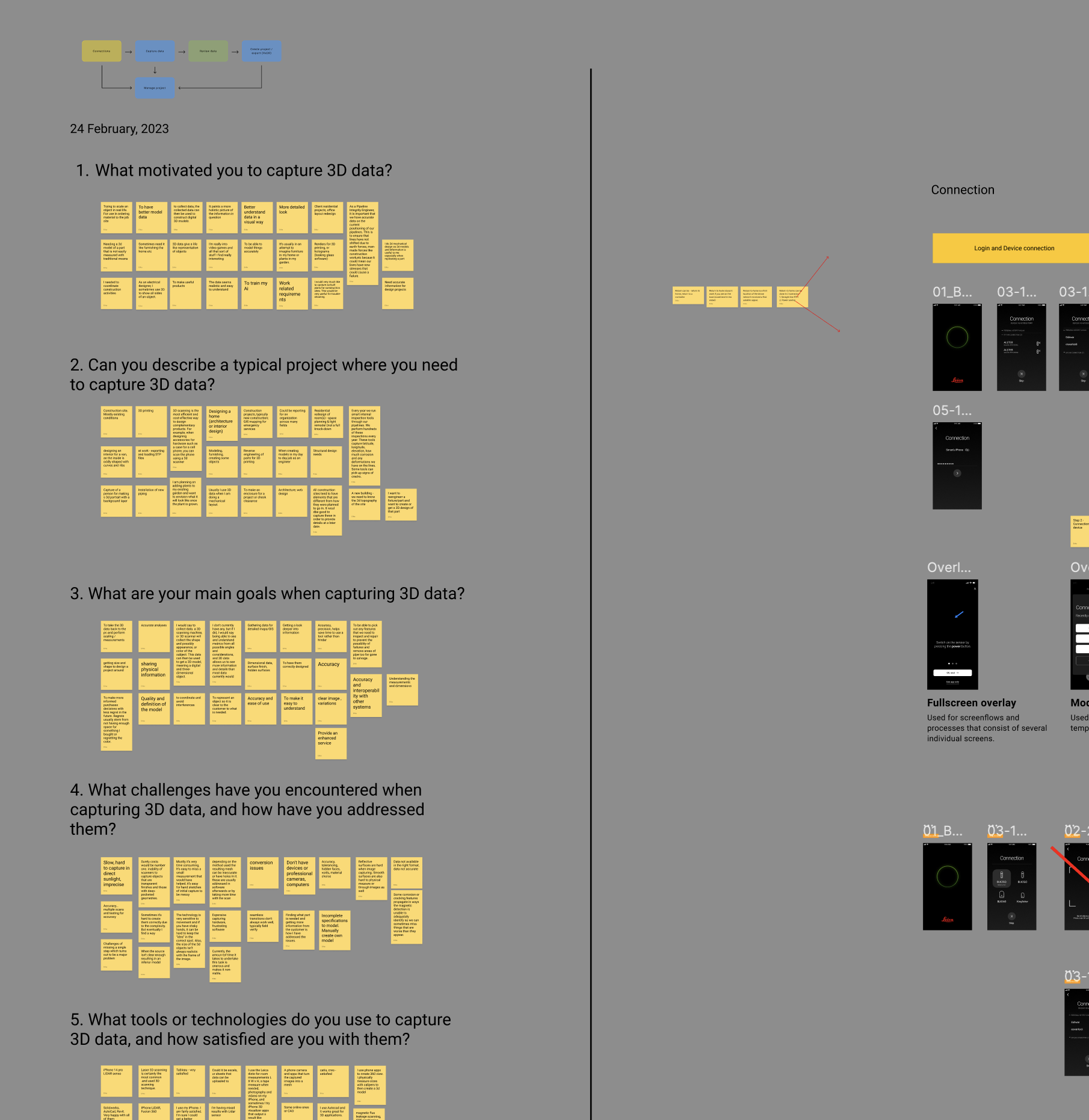
1. Research-Driven Insights. Ran +12 contextual interviews with architects, surveyors, and field drone operators — internal Leica specialists and external customers — alongside quantitative data from Leica's geospatial user base. Both sources pointed to the same failure point: cognitive overload during the flight setup and emergency landing decisions.
2. Ownership. Partnered with PMs to lock high-level product scope, and with engineering to define system-wide interaction rules.
3. Technical Constraints & Design. Worked within strict engineering constraints to prioritize essential spatial metrics over non-critical UI elements during active flight mode.


Design process
Research and design ran in two-week cycles alongside the hardware and firmware teams. Contextual interviews with architects, surveyors, and field drone operators surfaced a shared blocker: 3D capture demanded survey-level expertise and users want to simplify it to envolve more mid-level professionals to capture the data. That insight shaped an early hypothesis — collapse the workflow into 3 simplified journeys, instead of +6 steps — which we tested through low-fidelity wireframes before committing to the final UI.
user persona
Across every user group interviewed — architects, engineers, surveyors, and drone operators — the same tension came up: they needed the precision of professional 3D capture without the specialist training it normally requires. The redesign had to earn their trust in autonomy while still giving them a clear way to intervene when something looked wrong.
Primary persona:
The Trusted non-expert operator. Needs professional-grade 3D capture accuracy without survey-level training; wants to trust the system's autonomy but needs an obvious, low-stress way to intervene when something looks wrong.

user flow
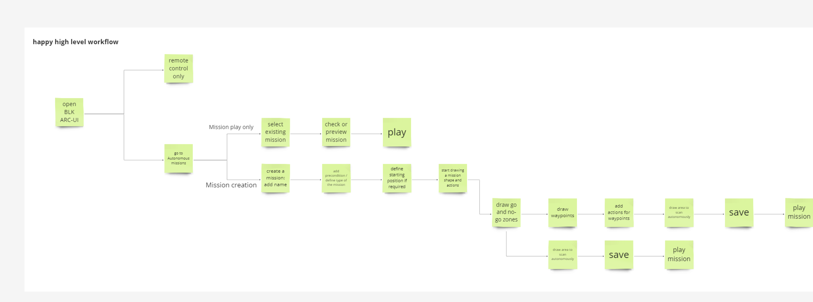
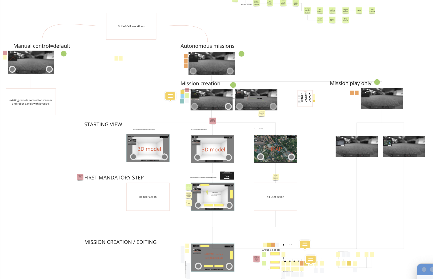
User flows helped us identify potential problems with our product and understand the best ways for our users to interact with the application.

Consolidated complex drone navigation into 3 primary user journeys:
Plan Flight: Autonomous boundary setup and pre-flight safety checks.
Monitor & Capture: Real-time 3D point-cloud streaming with dynamic feedback overlays.
Safe Landing & Sync: One-tap landing triggers with instant local-to-cloud asset sync.
research insights
1. Unlike lightweight survey drones, the BLK2FLY's require a wider safety rules to comply with regulations. Field operators frequently attempted to fly into narrow or crowded spaces, where the drone risked collisions or sensor blinding. The finding showed that due to physical bulk of the drone, companies would chose to buy other equipment.
2. The flight window of BLK2FLY is 10min. Operators suffered "battery anxiety," often aborting missions prematurely.
plan flights
After clicking on the 'Plan Flight' button, the main overview of the front camera will appear, allowing users to take off, initiate scanning, or access various settings necessary to begin their journey.
%20(6).png)
Monitor & Capture
Once a scan begins, the interface shifts from setup to live feedback. Operators see the point cloud building in real time, a progress bar tracking scan completion, and overlays that flag under-scanned surfaces before the mission ends, so a gap in coverage is caught mid-flight rather than discovered back at the office.
%20(5).png)
Safe Landing & Sync
Landing carries the highest risk in an autonomous mission, so the decision was reduced to one choice: land in place or return to home. Confirming either option triggers an automatic sync of the captured data to the cloud, removing a manual file-transfer step that previously required a separate desktop workflow.

Intuitive Tooltips for Remote Controller Mastery.
.png)


Create projects
Effortlessly manage and organize your scans with intuitive project organization feature. Seamlessly group and categorize your scans within projects, ensuring a systematic and streamlined workflow.
%20(3).png)
Impact & Outcomes
Task Completion: Reduced autonomous flight setup time by 80% — from ~15 minutes to 3.
Error Reduction: Reduced accidental mission aborts by 35% in testing, via dynamic landing feedback.
Design System Efficiency: Standardized Leica color tokens into a centralized Figma system, cutting frontend build times across Leica Geosystems.
These results were validated through iterative usability testing with internal and external users, including Leica Geosystems field operators, product owners, and construction engineers, and directly informed the centralized Figma design token system now used to speed up frontend builds across the Leica Geosystems suite.